How pygeoapi works
pygeoapi is a Python-based HTTP server implementation of the OGC API standards. As a server implementation, pygeoapi listens to HTTP requests from web browsers, mobile or desktop applications and provides responses accordingly.
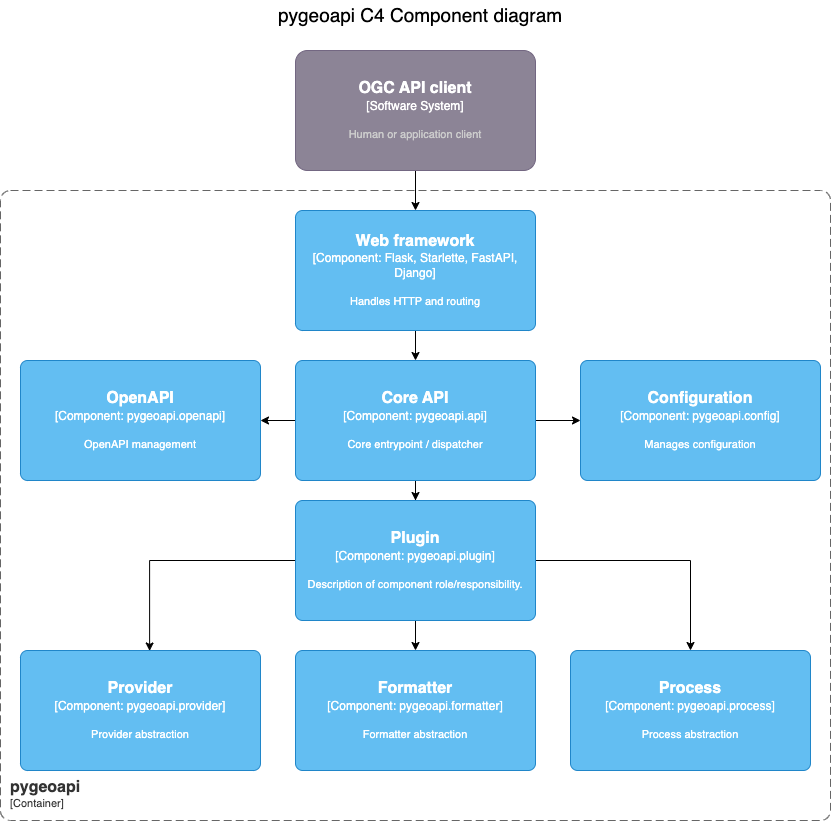
At its core, pygeoapi provides a core Python API that is driven by two required YAML configuration files, specified with the following environment variables:
PYGEOAPI_CONFIG: runtime configuration settingsPYGEOAPI_OPENAPI: the OpenAPI document autogenerated from the runtime configuration
See also
Configuration for more details on pygeoapi settings
The core Python API provides the functionality to list, describe, query, and access geospatial data. From here, standard Python web frameworks like Flask, Django and Starlette provide the web API/wrapper atop the core Python API.
Note
pygeoapi ships with Flask and Starlette as web framework options.